Thursday, June 20, 2013

One Blog- Four Parks cause we finally have Internet!!!!

Internet has been really scarce out here. We're in Moab, Utah now and have good 3G so we're catching up. 

BRYCE CANYON NATIONAL PARK, UTAH

When is a canyon not a canyon? When actually, it is formed when rain and ice soak into the porous sandstone, freeze, expand, and breaks away stone between stone forming amazing towers.
The hikes at Bryce go up and down and through these "Hoodoos" so you see the views from high up...


up closer.... ( This looks like a congregation waiting for the sermon don't you think?)


and directly across from you so you can almost touch them.

Some rock is stronger than others . This is call " the windows"


Bryce had endless great photo ops like these queens and their court. Each is a hundred or so feet high.


KODACHROME BASIN STATE PARK, UTAH

 We took a day trip to nearby Kodachrome State Park. It had totally different rock structures.


Doesn't this look like a cooking pot of some sort. Wonder what Mother Nature is cooking in there??


CAPITOL REEF NATIONAL PARK

We took the very curvy  Utah state highway 12 to go from Bryce to capitol Reef NP . A beautiful up and down and zig and Zag road. So, We're driving along and there are a bunch of  orange signs by the road with a picture of a cow. WE assume- ok look for wandering cattle. We come around a bend and this is what we see! There are more cows there than the photo displays.


We follow very slowly behind them  for a bit, then one of the teenage cowgirls rides over and tells us, "Just drive through, they'll move for you". We did, but the big cows didn't like us crowding the calves and quiet indignantly tried to block us off. They also pooped all over the road, which then got flung by the tires onto our truck and trailer. ICKY! and no campgrounds will allow washing of trailers!

Capitol Reef was beautiful with towering walls of rock but to be honest, we were hiked out so we took the scenic ride then relaxed at the campground before sharing dinner with an interesting Australian couple from the next site.


ARCHES NATIONAL PARK

Arches was worth the travel. This is "Landscape Arch" 306 feet long--longer than a football field. In 1991 some Hikers were standing under the arch, they heard a CRACK, looked up, and ran for their lives. The 60 foot slab of arch is on the lower right of the picture.


This is Pothole Arch. If you can make out the people under it you can see how big it is. It was actually one arch and a huge pothole eventually wore it's way through forming 2 arches.


Gary's favorite godess of the outdoors at broken Arch!

There is no end to what the imagination can do with the shapes these rock take. P.S. the wind was so strong, no way could anyone keep a hat on!!


Delicate Arch required a bit of a climb . Check out the proportion to the family posing for a picture under it.


Just one more amazing erosion mountain (about 500 ft high) at Arches. Note the old house. Someone thought this spot was heaven and tried to live here. His new wife insisted on this cabin upgrade to one with a wooden floor.


Finally, this is the view from behind our trailer at our campsite at arches NP. Sometimes it's worth it to forego electricity and water hook ups!


Wednesday, June 12, 2013

Horseshoe Bend On The Colorado

We're in Page, Arizona. Another 100 degree day, so we hiked across the sand to see Horseshoe Bend on the Colorado.


This is the view at the end of the short, but sandy hike.

It's a thousand feet down to the water! Check out the size of the boat. This picture is zoomed to the max.


 In the afternoon we took a smooth water raft ride from the Glen Canyon dam down river to horseshoe bend. The river water is released at the Glen Canyon Dam  and is a constant 47 degrees. This kept the ride relatively cool but only three of us tried to swim in it at our rest stop. ( Well, we put our feet in)


Recognize the Island from the photo of Horseshoe Bend?


At our rest stop, we walked to a wall with lots of petroglyphs. the stairs one is identifying a path up the walls.


Topped off the day with some Pizza and this morning we travel to the cool elevations of Bryce Canyon.

Tuesday, June 11, 2013

When Is A Canyon Not A Canyon?

When it's a sandstone slot canyon.
         Today we visited Upper and Lower Antelope Canyon in Page, AZ. This is Navajo land and you have to pay for guided tours. The guides are knowledgeable and very helpful with angles for camera shots.
          Flash flood waters over the ages carved down into the rock creating fascinating deep narrow "slot" canyons. Here we are at the entrance to Upper Antelope Canyon, which is more like a cave with a few holes in the roof that let in light. We were with a large group in this canyon.


The canyons are dramatically tall and beautiful inside!

Then we went to Lower Antelope Canyon which is less visited . Our guide is going into the entrance of the canyon and yes, it really is that narrow. after entering, we descended several flights of ladder-like steps There were only three of us so the tour was longer and much more fun.


It is huge inside also. (That's not water at the top--just the camera expressing amazement.) The level of the sand floor varies by many feet each year depending on the flash floods. Small floods deposit sand, large ones clean it out as much as 10 feet at a time.


The sandstone contains quartz, which adds purple coloring.

We went through narrow sections as well. This canyon was up to 150 feet deep and about 1/2 mile long. gary is actually stand on the path.

The lighting varies with every turn and every hour of the day. We took over 100 photos and it was not easy to limit them for this blog!


Monday, June 10, 2013

Intrepid Explorers Challenge The Heights Of Zion! and Grand Canyon North Rim was lots of fun and cooler.

Eight miles of trail roundtrip, 2300 feet in elevation , breathless views--- we braved it all-- to Observation Point! (by the way, it was either paved, easy rocks, or beach-like sand.)

On the way up we traversed a gorgeous slot canyon.


When we got to the top and walked across the mesa to the point, it looked as if we were walking through the dunes on the way to the water at Plum Island. The view from the top is amazing!


Since we are having considerable technical challenges creating this blog. Please excuse the combining of locations.

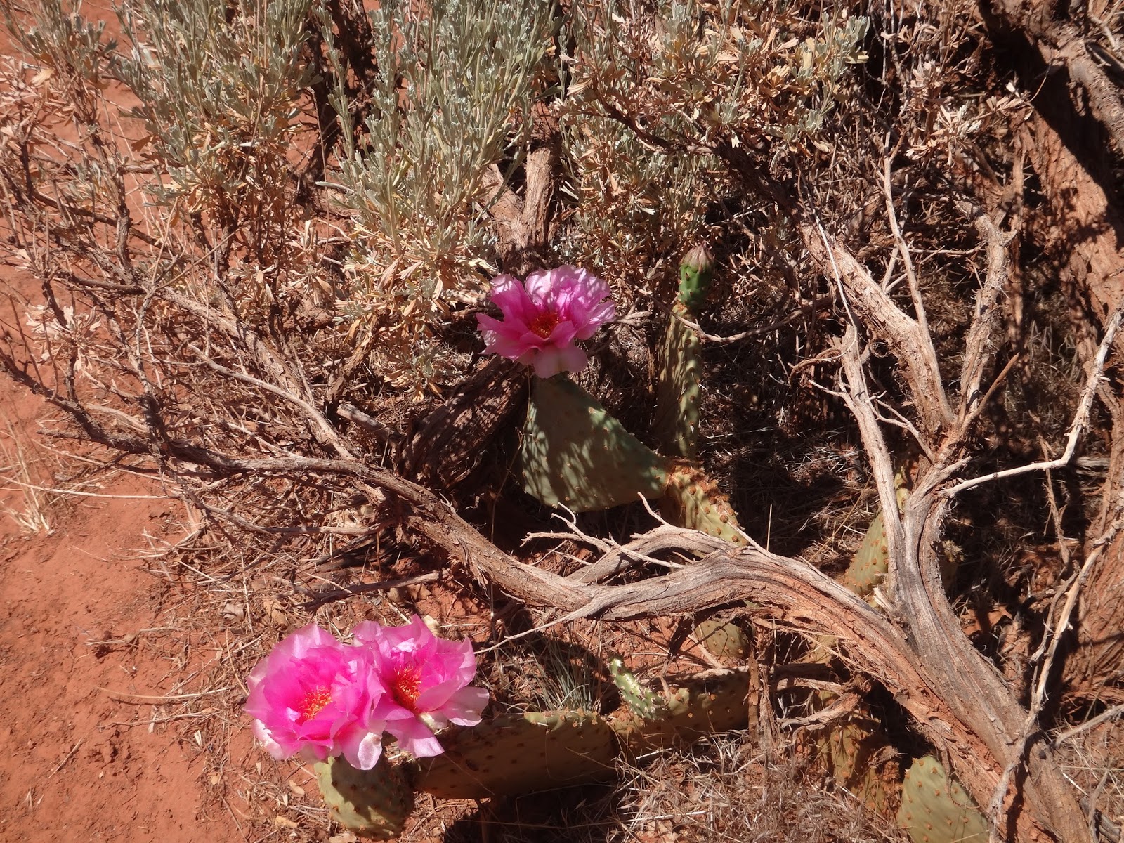
Two and a half days at the North Rim was perfect. The hikes are more gentle and wandering and the views of the canyon are great. You have seen pic of the canyon, not a lot different from the other side so we will stick with nature. This time of year, there are lots of random flowering cacti so they deserve recognition.
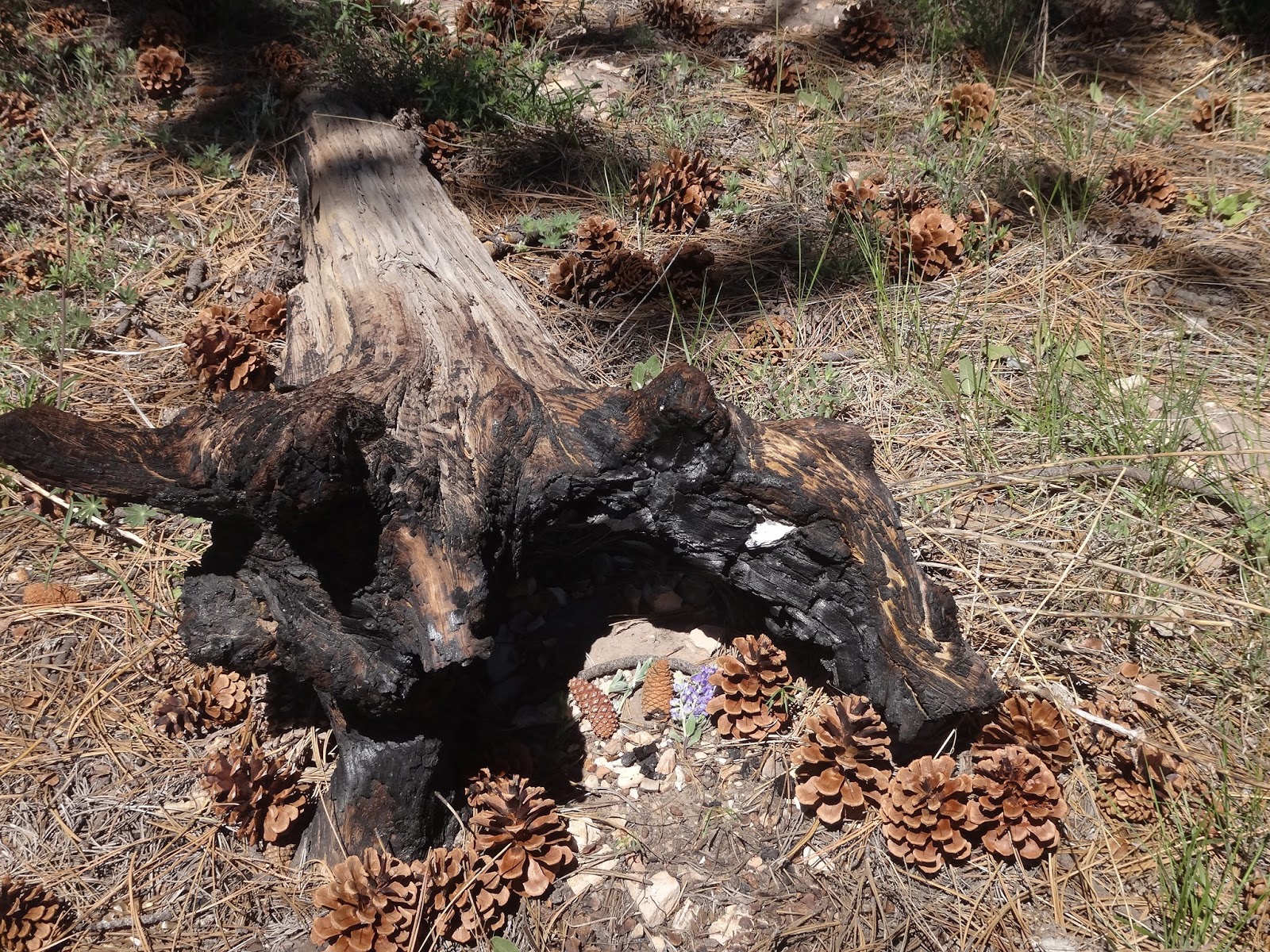
Hey girls! We found a fairy house with two pine cone fairies sitting by their campfire.


No photos on this next part, but imagine dinner our last night in the magnificent North Rim Grand Canyon Lodge. First, drinks on the veranda overlooking the canyon. Then we moved in for dinner. Every table had views of the canyon as the sun set.

Afterwards, there was an astronomy club set up on the veranda giving everyone views of Saturn and its moons, a globular cluster of stars, a binary star, etc. One of the telescopes had a 20" diameter mirror! (The famous Clark telescope at the Flagstaff had a 24" lens.) A nice way to finish our visit to The Grand Canyon


Tuesday, June 4, 2013

Every Day Is A New Amazing Day At Zion


Rock formations that look man made are actually created by Mother Nature.


This is only the beginning of yesterdays hike that was switchback after switch back. called "Walter's Wiggles", they ascend to Angle Landing which is the chains walk with 1400 foot drop. Nope, not Joy!
Instead we turned left to the West Rim Trail for our view.


Oh, Jen called to say "Hi" so we had a respite stop to chat. We got the stink eye from a few other hikers as we stood and chatted.


Note how close Joy is to the edge( 1500 feet down). Thanks. Bonnye for the inspiration to slowly face my fear of heights. Angels Landing chain path is that narrow knife edge just to my right. Nope, still not that brave.

Cool rock formations. 


There are only 170 California Condors in the wild and we got to see #99 with his 9 foot wing span.


AHH finally back to the bottom. 98 degrees but at least it's flat!


East of Zion


The hills and mountains on the east side of Zion are called "slick rock". They look like gigantic mud piles! Or, Shulmpy cupcake frosting.


This one is called "Checkerboard Mesa"


It seems that mountain goats hang out on checkerboard on a regular basis. We decided that they are assigned shifts so that they will always be there for animal seeking tourists.


Right after going thru the mile long scary tunnel, we stumbled on a slot canyon within its first 10,000 years of formation.


Gary's favorite "Mountain Woman"
This hike was just opposite the tunnel and had some pretty hairy look downs!


Coral Pink Sand Dunes State Park--Just outside of Zion is really fascinating.
Lots of movies filmed here. Also new generation sports.


They rent sand boards and sand sled as well as ATV's at this 3700acre park where Dune Buggy trails are the main event. This little girl is about Kaias age and this was her first time. It actually slides quite slowly.


Saturday, June 1, 2013

We LOVE Zion Nation Park

We are having a wonderful here. The views are postcard perfect everywhere, the weather is beautiful- warm and dry with a cooling breeze . Lots of hiking on well maintained trails many of which are paved. This is the view just along the shuttle road. ( no cars allowed in season)

We went to the west side to Kolob canyon for a hike.

We took a hike that started like this


Evolved into this along a creek bed


and ended at this ginormous double arch of sandstone called Double Arch Alcove. great place for lunch!


We took a ranger tour on the shuttle bus and stopped at view after view like this one. By the way- the view from our campsite is almost identical to this one- on all sides! Umm $9/night cause we are "seniors".


These guys camped out on the rock face during their climb!!!


This is the Virgin River Canyon near the beginning of the creek tour in the Narrows. We passed cause Joy and Gary don't like wading in 50 degree water. The Virgin River is the one that carved the canyons at Zion and what a beautiful task she accomplished!


Only the risk of ferocious wildlife entering our campsite keep us wary.