Thursday, June 9, 2011

On To Seattle

We made it to Seattle! Here are Joy and my mom, Hilda, as we sit down to a festive dinner. You know we don't get shrimp cocktails in the trailer!

For the next week our adventures will be in Seattle, but there was one amazing (I need a new word) thing on our way out of Grand Coulee. We learned about the geology that shaped the western United States. During the last ice age glaciers blocked the flow of the very large Clark fork river that drains the Montana area. The blocked river built up a lake as big as an inland sea---thousands of feet deep. When it got big enough to push through the glacier barrier, it apparently broke the glacial dam and drained in a day creating a gigantic rushing river to the Pacific. They think it moved at 60 mph, scouring out the lava rock base of the area hundreds of feet deep in this one rapid flow. They have found large areas down stream where the landscape is rippled 30 ft high and looks like ripples in the sand at the beach. These blockages and floods apparently happened many times during the end of the ice age.

One place we stopped is called Dry Falls. The geologists tells us that the water here created a temporary falls as high as Niagara and several miles wide, eroding the base for miles back from its start.

We drove through spectacular great flood-eroded canyons for at least an hour! Beautiful countryside.
Then we came to a park that held a petrified forrest. Sure enough, the petrified logs looked like real wood, growth rings and all, but were rock!
The park also had petroglyphs---pictures carved on the rocks thousands of years ago by people back then. These at the visitors center had been removed from an area that was going to be flooded by the Grand Coulee Dam.
PS: as I write this, I'm drinking a great cup of Seattle coffee. Thank you Seattle for getting the good coffee movement going!

Wednesday, June 8, 2011

FDR Was A Genius!

But first--- we left the trailer in Missoula for the week while we sprint to Seattle to visit family. Driving without the trailer was a thrill. We could pass other cars. Gas lasted forever. 

The highway followed a narrow pass through steep forested mountains across Idaho and the remainder of the Rockies. Then we came to the gently rolling hills of eastern Washington. It looked like wheat was just coming up.
We stopped at the Grand Coulee Dam for the afternoon and night. Thank you Rob and Nan for the suggestion!

So about FDR.....a number of places along this trip we've come to places where it was still obvious how hard life must have been during the depression. FDR fostered public works programs that gave people work during desperate times, but also built things that normal political wrangling would have prevented.

A project to build a dam on the Columbia river for irrigation of the Columbia Valley had been stalled for 13 years. In 1933 FDR jump started it with Government money. It provided thousands of jobs. As it progressed and WW II began, the project was expanded to include generation of electricity to help the war effort. It was completed in 1942. The dam was enlarged and more generators added with completion in 1980.

The first picture below shows the dam with a tour bus on top at the right. It used 12 million cubic yards of concrete for construction and became the largest concrete structure in the world. It is 300 ft high above the water.
 In the next picture, the parallel metal "pipes" up on the hill side are used by the dam's pumps to pump 2% of the river's water into a canal system that irrigates 500,000 acres in the Columbia valley!

( Keep 1933 - 1980 in mind. ) This dam has 18 water driven turbine electrical generators and is the largest hydroelectric producer in the USA. The picture below shows an 80 ft diameter blue cover over just one turbine/generator. The horizontal yellow thing is a crane. The one farthest away can lift 2000 tons!!!!
The water-feed tunnels coming down the slope on the right each feed one turbine. Each tunnel carries twice as much water as the entire Colorado River. A single turbine makes enough power for the entire city of Seattle!
Before the modern computer control system, the power from each generator (enough for Seattle) was monitored by the simple instrument set here.
And the water turbine below was connected to the generator top end by the 11 ft diameter steel shaft shown here----Enough power for Seattle carried by a single giant steel shaft????
Today were headed to the Petrified Forest (although I don't think it's changed much). Then on to Seattle.

Monday, June 6, 2011

Smoke Jumpers

Turns out Missoula has one of the country's major forest fire fighting Smoke Jumper centers. In season this center has about 80 jumpers in residence. They gave tours! These men and women are the. NavySeals of fire fighting.
    This is a lucky find because we have been reading a novel called "Smoke jumper" that takes place in here in Missoula.


A Day of R and R

We are in Missoula, Montana at a beautiful campground.  We have a day here to do laundry, visit a bookstore, and store the trailer for a week before wego to Seattle to visit family.

Ok we also celebrated being in a big city by getting supermarket fried chicken for dinner. Yum!


Saturday, June 4, 2011

At Last! Beautiful Sunshine, Waterfalls, and Bears

We caught a glimpse of a mama bear and a teeny weeny cub from the car as we were driving to our hiking trailhead. To be honest, we were a little nervous about bears. Bears like water, paths and trees which exactly described the hike we wanted to take.  Plus, it was windy and loud so the bears could neither hear nor smell us. To our great relief we soon met up with a hiking club who were taking the same  hike as us.  They were great company and welcomed us to join them. Several of them had bear sighting stories ( they were local) but we did not see any more bears today. The hike was a bit snowy but the scenery was spectacular. 
We  hiked to two spectacular water falls and over a few rushing rapids but the spray was so wild none of the pictures of the falls came out. This one is a mini falls we passed on the way.
The sky was crystal clear, giving great views of the gorgeous rugged mountains. Yes, the lake water is actually the color in the photo.

 This next one shows Jackson Glacier, with avalanche trails going down the slope to the left.
On the way back to the campground, just after the avalanche warning area, we stopped to look at one steep, high mountain right next to the road. Joy noticed high up on the mountain a large waterfall. A minute after I looked where she was pointing, it suddenly stopped flowing.  Then the waterfall suddenly started again and it was pouring right onto old avalanche trails below it. We could hear the water fall clearly even though it was several thousand feet above us.  Then, just like you hear on TV, we heard low, deep rumbling. WELL, that was enough for us. We returned to the car-quickly-and left.

Friday, June 3, 2011

Glacier NP Is Like What? This is June 3'd!

 Actual unretouched photo on the famous Going To The Sun Highway, which will not be opened all the way across until July this year.
The mountains in this park were ground into sharp vertical shapes by glaciers. Pictures can't begin to capture it. Here's a few anyway. By the way, the morning rain and low clouds gave way to sun at 5:30pm. But it's light 'til 9:30, so "OK".


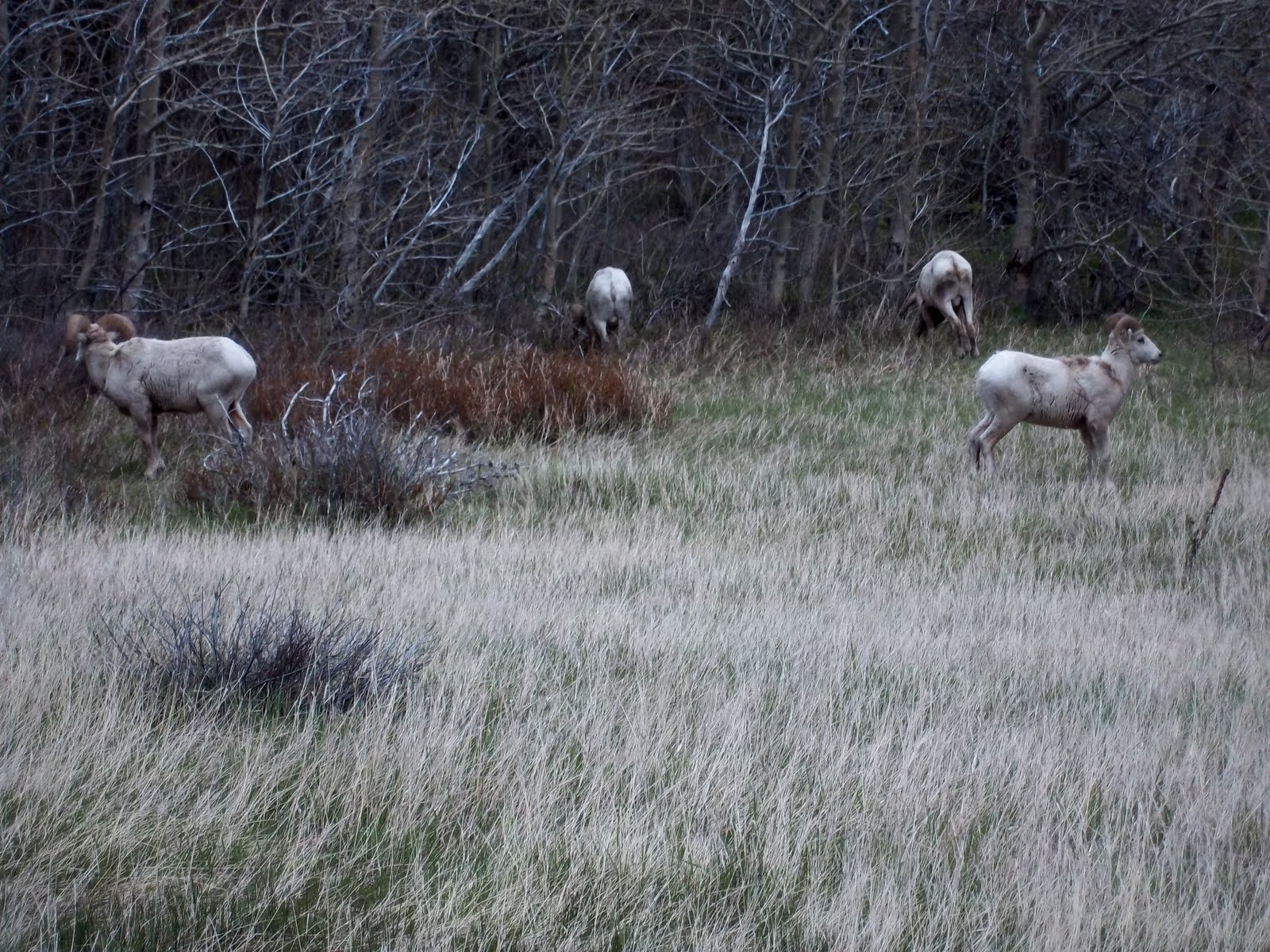
Joy caught big horned sheep in action.

The rushing water is from the rain. The Rangers say the spring melt and run-off hasn't even happened yet. In fact, trees haven't begun to bud yet in most places.
We passed signs that said, "Don't stop--avalanche zone". We laughed until we passed an area where one had recently gone over the road--look at the smashed timber----gulp!
Tomorrow is supposed to be good weather, so we're packing the bear spray, SPF50, and going hiking.

Made It To Glacier National Park!

Even here we have 3G coverage (Verizon) and can turn on our own local wifi hotspot---amazing!

Two days ago we went to Little Big Horn National Park. It was fascinating on many levels. The entire series of battles may have been due to poor information, communications on both sides, and the "fog of war". There were so many accounts written that they have been able to reconstruct the battles fairly well--even to marking the area with gravestones where each soldier and some warriors fell. (Weather note-- it was actually warm enough for short sleeves!)

We spent most of yesterday crossing Montana---one breath-taking vista after another. Alternating perfectly flat farmlands (with old farm buildings above), rugged, convoluted hillsides, sweeping valleys. We could often see 30 miles, grassland and not a tree in sight--- there are no similar views back home except from the top of Mt. Washington.


Poor Montana has had wide-spread flooding. Some highways were still closed. (I90 had been closed before).
We went through Great Falls and stopped at the Lewis & Clark Museum. What an interesting look at early American history!

Lots of rain as we continued on to Glacier. Only a few glimpses of the mountains through the low hanging clouds as we approached. But as the weather clears, it looks to be all they say.
From the trees, snow cover, and 40 degree rain, and winds high enough to rock the trailer, you might think we're rushing the camping season, but there are a number of tent campers here, as well as other trailer folks. (Two thirds of the campground is closed due to standing water). Though each night when we can retreat to the comfort of our snug trailer, we are happy with our off-season strategy.
     We're off to the visitors' center to see what's up.
     Tomorrow is supposed to be sunny and upper 50's.